The 145,580-acre Diamond Bar Allotment gained notoriety in the 1990s due to ranching impacts on the endangered
Gila trout. When, in 1995, an Environmental Impact Statement and Record of Decision mandated reduction in cattle numbers from 1,188 to 300 head, permittee Kit Laney of the Diamond Bar Cattle Company (DBCC) refused to sign his grazing permit, but continued to graze cattle on the allotment.
Appeals and litigation followed and on February 23, 1999, the United States Court of Appeals for the Tenth Circuit issued
Diamond Bar Cattle Company v. United States which upheld the Forest Service’s authority to require the removal of DBCC’s cattle from the Gila National Forest based on its refusal to accept a new 10-year term grazing permit.
The court reaffirmed the longstanding principle that there is no right to graze federal lands but rather only a privilege permitted by the government through the issuance of a grazing permit that may be revoked by the government.
Upon losing the court case the Laneys were ordered to remove their cattle and pay more than $55,000 in fines and damages for unauthorized grazing of National Forest lands.
The Diamond Bar Allotment remained cattle-free until spring 2003 when Laney challenged the system. Forest Service personnel first saw cattle on the allotment on April 23rd.
Two days later Kit and Sherry Laney sent the Secretary of Agriculture a letter with attached Warranty Deeds for a fee interest right to water and range for livestock on the Diamond Bar Allotment. The letter states that anyone who attempts to remove livestock from the allotment will be in violation of state laws and subject to prosecution as individuals.
The Gila National Forest notified the DBCC by letter on April 29, 2003, to remove their livestock by May 9, 2003, under provisions of 36 CFR 261.7(a)(b) [prohibitions against placing unauthorized livestock on National Forest System Lands, and not removing unauthorized livestock when requested by a forest officer.] On May 10, 2003, Gila National Forest personnel visited the allotment, and estimated livestock numbers at about 150 head. It appeared livestock had been added rather than removed.
In June 2003, the U.S. Attorney for New Mexico filed a motion under the same court case originally brought by the Laneys in 1996, asking that the Diamond Bar and Laney Cattle Companies be held in contempt of court for violating the federal court’s 1997 judgment.
That same month Michael Sauber, President of the environmental group, Gila Watch, reported from a Forest Service source that roughly 300 head of cattle were then on the allotment.
In late September, due to lack of court action, six environmental organizations moved for an
injunction in New Mexico federal district court seeking an immediate halt to the illegal grazing.
On December 18, 2003, Federal Judge William P. Johnson in Albuquerque held the Diamond Bar and Laney Cattle companies, and their owners Kit and Sherry Laney, in contempt for violating the court’s December 1996 livestock removal order. The judge indicated he would shortly issue an injunction that would again order the removal of hundreds of cattle from the two former national forest grazing allotments at issue, both officially closed to livestock.
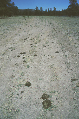
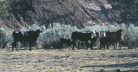
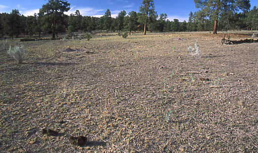
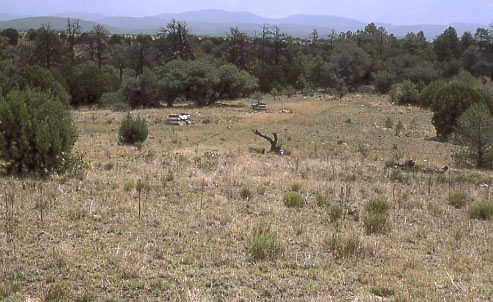
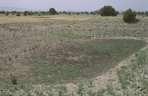
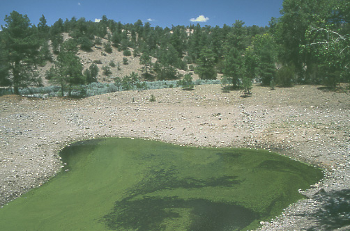
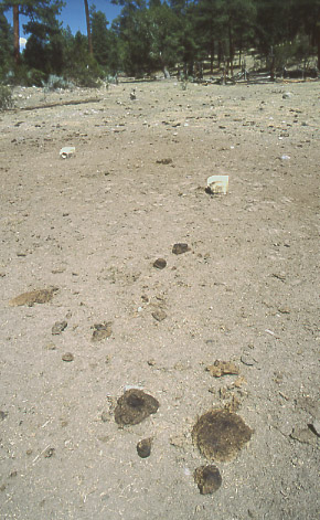
I visited the Diamond Bar Allotment on July 27th and 28th 2003 to witness some of the environmental damage that Laney’s illegal ranching had caused in recent months. The following photos were taken at that time.
For more information about the Diamond Bar Allotment and the surrounding national forest, please see my YouTube interviews with New Mexico environmental activist Mike Sauber:
•
The Reintroduction of the Gila Trout
•
An Experience with the Quivira Coalition