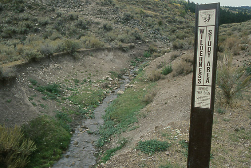
The Smithsfork Allotment (alternatively written “Smiths Fork Allotment”) is a 90,937 acre cattle and sheep allotment located in southwestern Wyoming northeast of Cokeville. Smithsfork includes a wilderness study area as well as streams that are home to the
Bonneville cutthroat trout, a fish that had been proposed for protection under the Endangered Species Act. In what some people have characterized as a
“politically motivated decision” the fish was denied such
listing in October 2001.
When the BLM developed its resource management plan for Smithsfork in 1986 it identified the allotment as its number one priority out of thirty-nine allotments in declining health with unsatisfactory management. The BLM noted that the allotment was being overgrazed in riparian and wetland areas, that livestock were poorly distributed, that conflicts were occurring between livestock and wildlife and that soils were being excessively eroded.
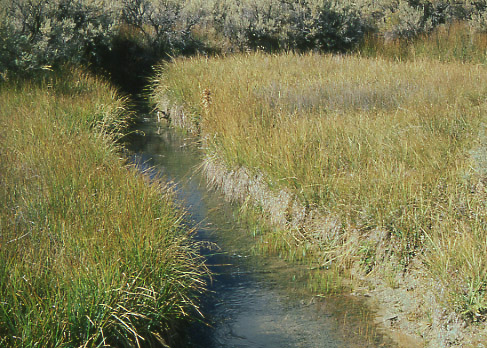
Fifteen years later the situation had not improved. Of fifty-eight miles of streams on the allotment, only nine miles were in proper functioning condition, with seven miles completely non-functional. Of the six miles of Raymond Creek that are home to the Bonneville cutthroat trout, only one-third mile was in proper functioning condition. BLM also admitted that the allotment’s rangelands were currently incapable of sustaining viable populations of native plant and animal species appropriate to the habitat.
In May 2001 BLM issued to all the Smithsfork permittees new four-year permits that allow grazing at higher levels than in 2000, the worst season of livestock rangeland damage in five years. That same month the
Wyoming Outdoor Council, a local environmental organization, filed a complaint alleging that the BLM had failed to comply with its federal mandate in 2000 to develop a final management plan prior to the start of the 2001 grazing season that would make significant progress in restoring rangeland health. The Outdoor Council also filed a motion with the U.S. District Court in Cheyenne for a temporary restraining order to prevent increased stocking on the allotment.
After a two-day hearing, the District Court denied the Outdoor Council’s motion, finding that the threat of continued livestock grazing was not “immediate.” Evidence showed that due to high livestock numbers and mismanagement, the Smithsfork Allotment had been in a state of “urgency” for proper management for at least five years. Hence, the court reasoned, that if the BLM’s mismanagement had made the threat “immediate” five or more years earlier, not much more resource damage could occur during the 2001 grazing season.
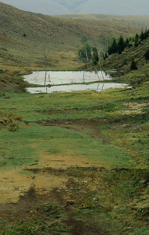
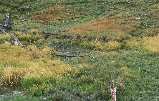
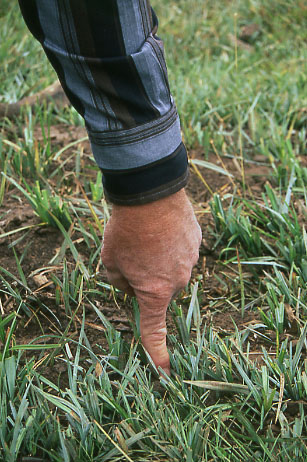
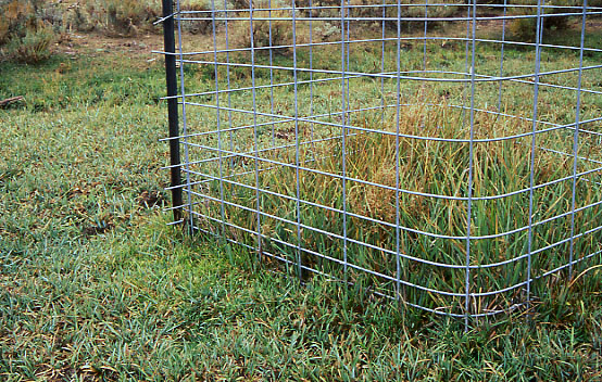
On the cloudy day of September 17, 2001, I was given a tour through part of the Smithsfork Allotment by Darrel Short, a retired range conservationist with thirty-five years of service with the BLM. The following photos, taken at that time, give a small indication of the damage that livestock have inflicted on the region.